
15 Beloved Places at Risk from the Western Solar Plan
15 Beloved Places at Risk from the Western Solar Plan
BLM fails to adopt a balanced approach, leaving the West at risk from solar development in inappropriate places

The Western Solar Plan has dropped, and some of the West’s most beloved places are about to opened up to solar energy development. We need solar energy, but not like this. How could this Plan reshape our world and the places that make the West so special? In this newsletter I’ll highlight 15 places at risk from the Western Solar Plan.
And stay tuned for our next edition, when we’ll dissect the Western Solar Plan, talk about more appropriate places for development, and explore how we plan to push back.
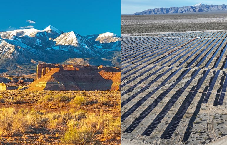
The Bureau of Land Management released its updated Western Solar Plan recently, and it has the potential to radically reshape the American West. Far from the targeted, smart-from-the-start approach they had been selling it as, it’s a massive giveaway to industry, eschewing what few environmental protections they had at their disposal in favor of opening up vast, vast swaths of the American West to solar energy production.
31 million acres of public lands – an area the size of Pennsylvania - spanning across the 11 Western states are being opened up for solar energy, with the vast majority concentrated in the Great Basin Desert of Nevada, Utah, Oregon, and Idaho. Nevada alone could see 11.8 million acres of land available for solar, affecting damn near every basin in the Basin-and-Range State, causing a fundamental transformation of what is by and large the least developed region in the lower 48 states.
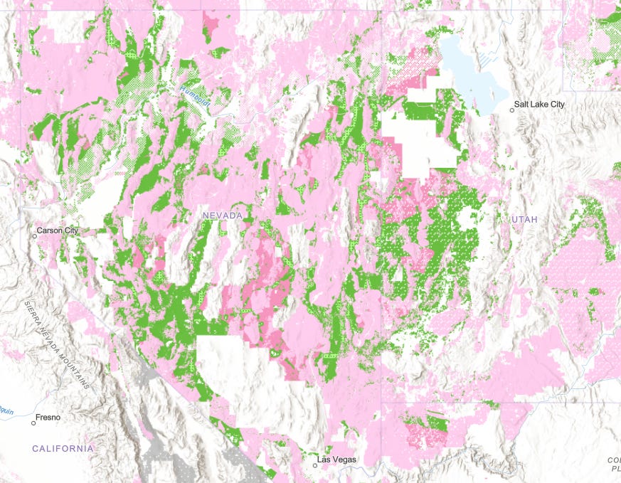
Other Western states bear a large burden, including Utah with 5 million acres, New Mexico with 4 million acres, Wyoming with 3.8 million acres, Arizona with 2.8 million acres, Idaho with 1.5 million acres, and Oregon with a little over a million acres. You can view the solar allocations and exclusion zones on this BLM mapper.
Utility-scale solar energy causes fundamental land transformation in the areas where it is sited. Land is graded smooth and covered with gravel and/or pesticides; drainage patterns are altered; native wildlife displaced and habitat permanently destroyed; and wildlife connectivity corridors are disrupted. Dust production and water consumption to abate it are also major concerns. In short, utility-scale solar development comes with numerous environmental impacts that cause harm to the ecosystems in which they’re sited.
The Western Solar Plan is an update to an earlier 2012 plan which guides solar energy on public lands. It’s intended to designate certain lands as open while excluding other areas where resources conflicts are significant and present obstacles to solar development. It also designates a number of design features which are intended to ostensibly minimize the impact of the projects.
But I’m not interested in design features. I’m interested in siting. Once the siting is done with, the rest is just tinkering around the edges. Whether we mow the projects or not; whether we allow wildlife back in through permeable fences or not; whether we have the panels elevated or not… once the bulldozers start blading ground, once disturbance starts spreading across a previously pristine landscape, well, it’s all over. We can fight about mitigation all you want, but to me the primary concern is the “Where?” not the “How?”
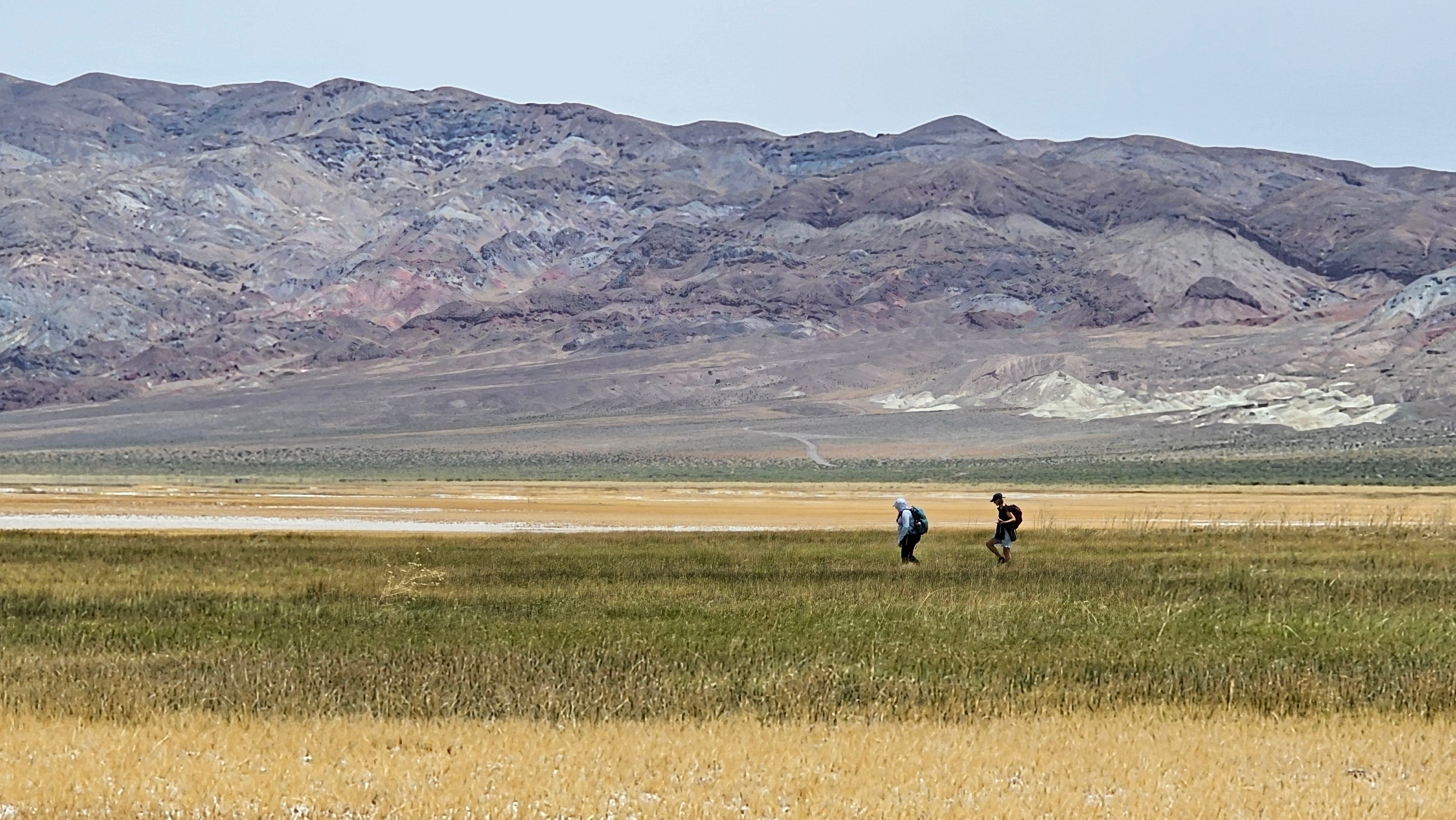
And the “where” contains enough heartbreak for a thousand lifetimes. Within those 31 million acres are so many places we care about. It’s easy to have your head spin when you start thinking about that sort of acreage. And looking at maps with these enormous green blobs makes it hard to wrap your head around a sense of scale. So I really want to dial in on some of the places that are at risk in the Western Solar Plan.
Here are 15 beloved places across the West that could be forever changed by the Western Solar Plan…
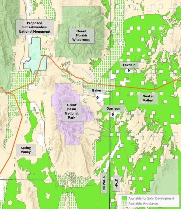
1. Great Basin National Park, Nevada
The Western Solar Plan allocations would make public land available for solar energy in a circle completely surrounding Great Basin National Park circumferentially. The areas open for solar also include parcels within the sacred Swamp Cedars, an area of spiritual and cultural importance to the Western Shoshone and Goshute peoples, which is now proposed for permanent protection as Bahsahwahbee National Monument. 7,000 of the 25,000 acres proposed for protection in Bahsahwahbee would be allocated for solar. Much of Spring Valley, the “Sacred Water Valley” of the Western Shoshone, would be allocated for solar energy.
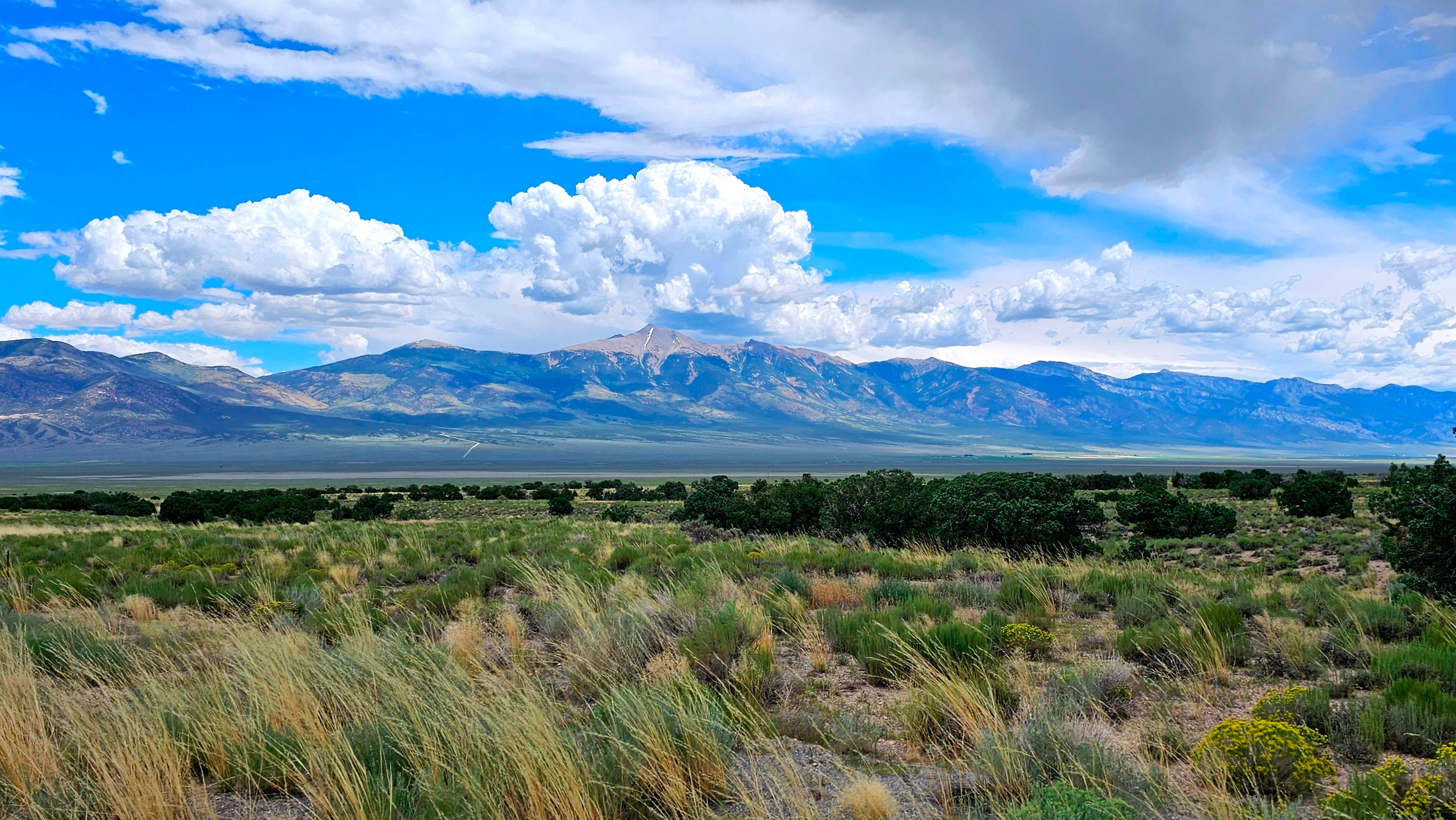
These areas made available for solar would also almost completely fill Snake Valley, surrounding the small communities of Baker, Eskdale, and Garrison. Snake Valley is an area of incomparable beauty, the gateway to Great Basin National Park, and a National Heritage Area. It’s part of the Great Salt Lake flow system, begging the question as to where the water will come from for solar development there – and what will be the downstream consequences?
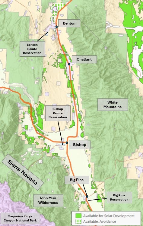
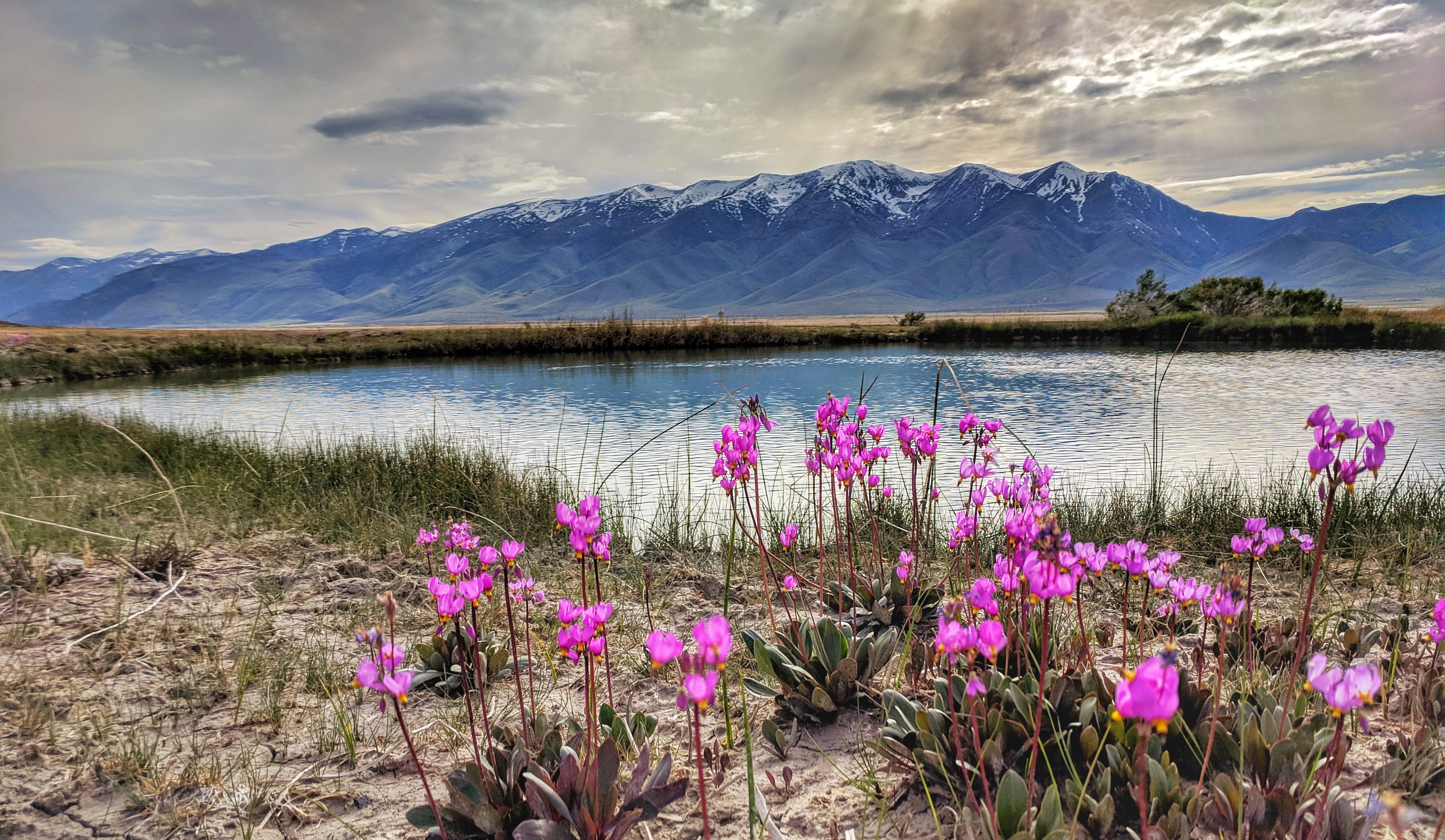
2. Eastern Sierra, California
I find it really impossible to believe that BLM would be so dumb as to allocate lands right at the foot of the Eastern Sierra in the Owens Valley for solar energy. Quite possibly the most beautiful place in America, the Owens Valley is also full of biodiversity and numerous communities and Indian Reservations. It could be the single worst place to site for solar in the entire United States. And yet 40,000 acres are allocated for solar between Inyo and Mono Counties, including a large area west of Bishop at the foot of the Sierra Nevada, and areas going up Highway 6 into Mono County including Chalfant and Benton.
I’m sorry but this is one of the most iconic and cherished landscapes in the world. What the hell is BLM thinking?
.jpg")
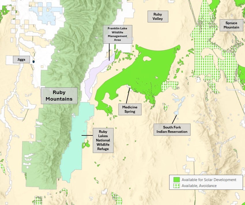
3. Ruby Valley, Nevada
The achingly beautiful expanses of Ruby Valley in northern Nevada would have tens of thousands of acres available for solar development under the Western Solar Plan. This would include an area in direct proximity to Ruby Lakes National Wildlife Refuge and Franklin Lake State Wildlife Management Area – both essential stopovers for migratory birds, who could be significantly disrupted by large adjacent solar fields. This area is also near the South Fork Indian Reservation of the Te-Moak Tribe of Western Shoshone Indians. These lands are also migratory habitat for Nevada’s largest mule deer herd. Lands that have undergone extensive habitat management for mule deer near Spruce Mountain would now be open for solar.
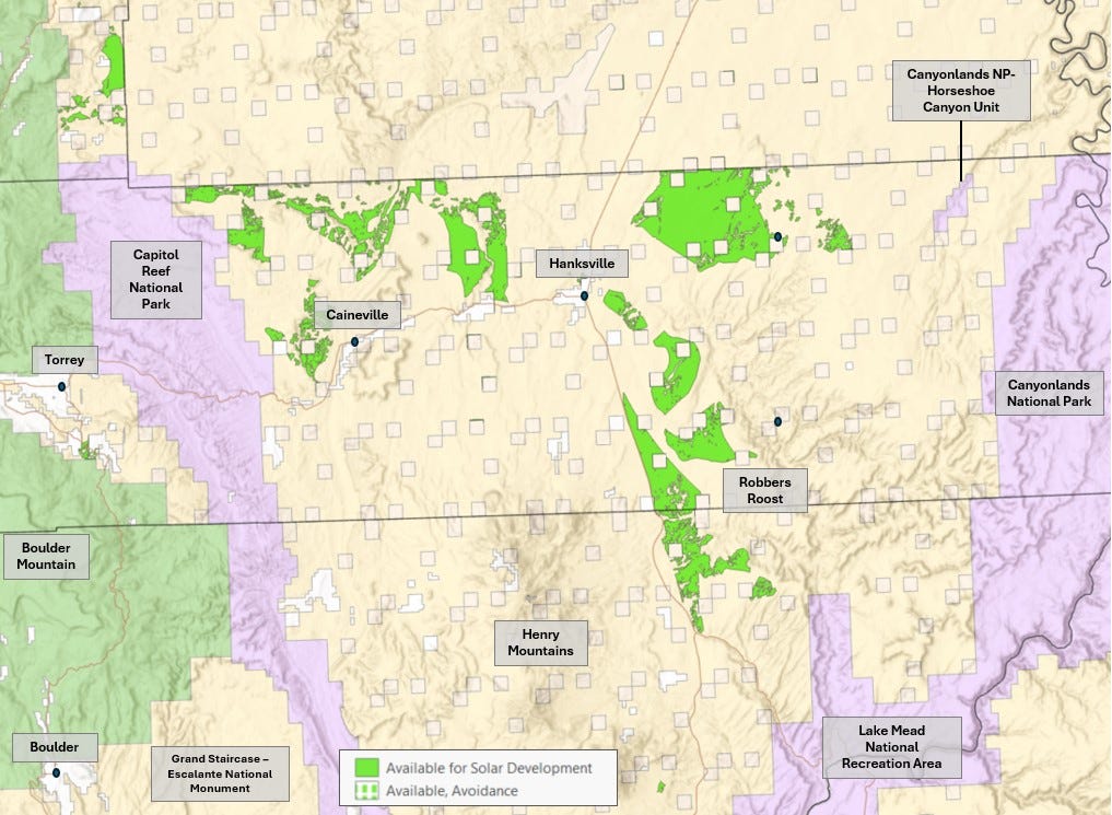
4. Canyon Country, Utah
Showing that there is no bottom for the depravity of the Western Solar Plan, it actually targets public lands in the incomparably beautiful Canyon Country of Utah for solar development. In particular there are a number of large parcels in the area of Hanksville. This includes areas to the northeast, on the gateway to Canyonlands National Park – Horseshoe Canyon Unit; to the southeast, in the Robber’s Roost area at the foot of the Henry Mountains; and to the west, all the way up to the border of Capitol Reef National Park. The Hanksville area is known as the real outback of the Colorado Plateau, sparsely populated, beautiful and wild, but increasingly an important part of the eco-tourism circuit in southern Utah.

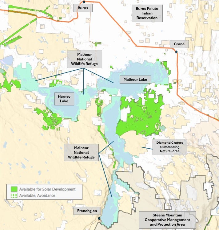
5. Malheur, Oregon
Areas surrounding Malheur National Wildlife Refuge in central Oregon are being made available for solar under the Western Solar Plan. Malheur NWR exists to protect important seasonal bird habitat in Malheur and Harney Lakes, and an extensive associated wetland system. This is an area of significance for the Burns Paiute Tribe, which has a reservation nearby. The lands made available for solar are wedged between Malheur Lake and the beautiful Steens Mountain, potentially severing connectivity between wild and protected areas. Lands being made available for solar abut the Refuge on all 4 sides, diminishing its habitat value and threatening to disturb the Pacific Flyway that the Refuge is a part of.

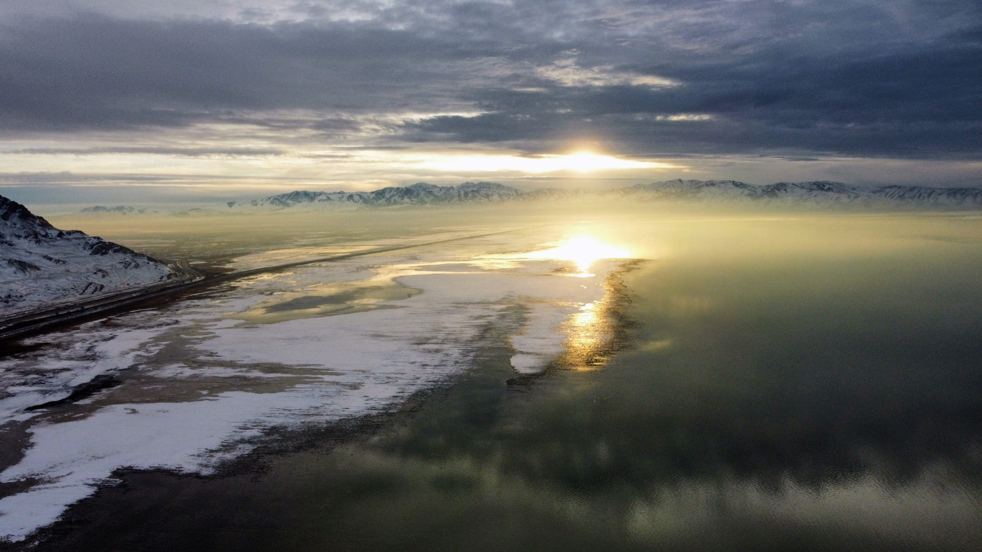
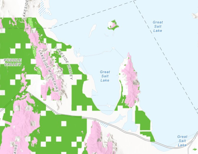
6. Great Salt Lake, Utah
It seems completely insane to make areas available for solar on the shores of Great Salt Lake, given the many escalating environmental crises there. But what do I know? I’m just some guy. Given that the lake’s shoreline is covered in wetlands that are important for migratory birds, perhaps solar may be less appropriate here.
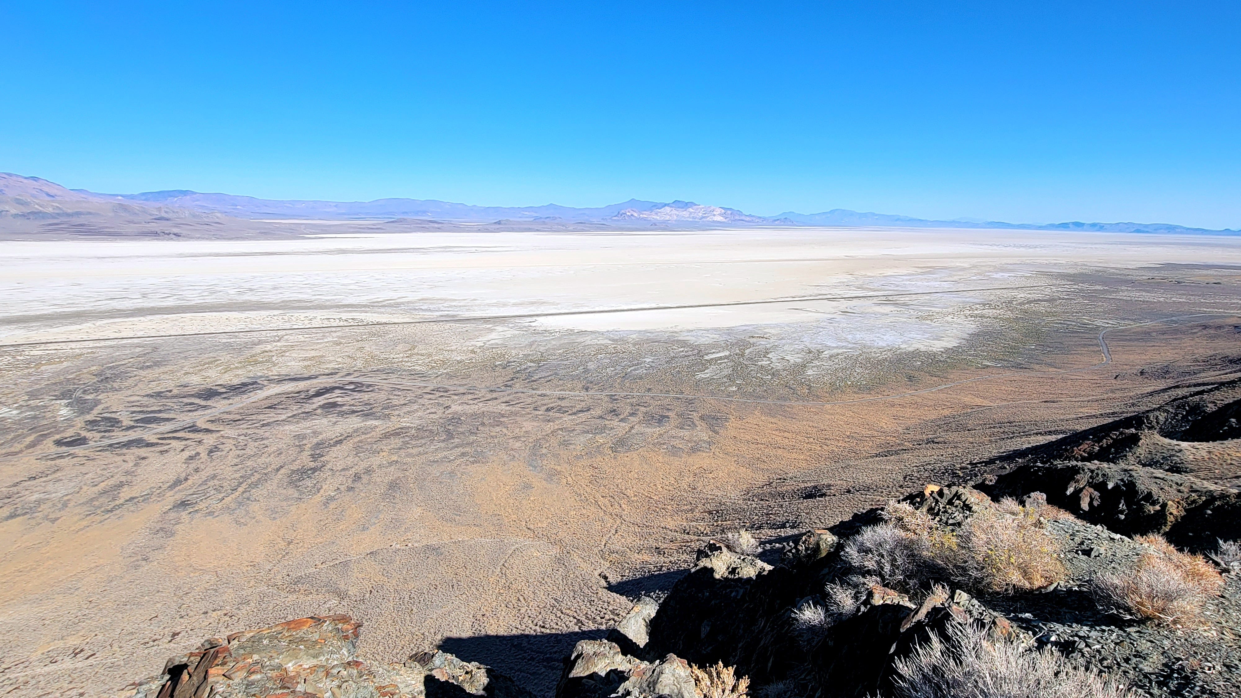
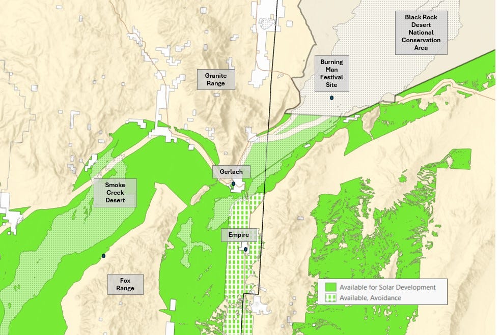
7. Black Rock Desert, Nevada
The Western Solar Plan would open up vast tracts in the Black Rock Desert area to solar energy. This includes lands surrounding the small town of Gerlach, home of the Burning Man festival. While the actual festival grounds out on the playa are not open to solar because they are within the Black Rock Desert National Conservation Area, the famed Black Rock Playa would be lined with lands available for solar to the south. Also being made available are the vast majority of the Smoke Creek Desert and San Emidio Desert, including on seasonally inundated playas.

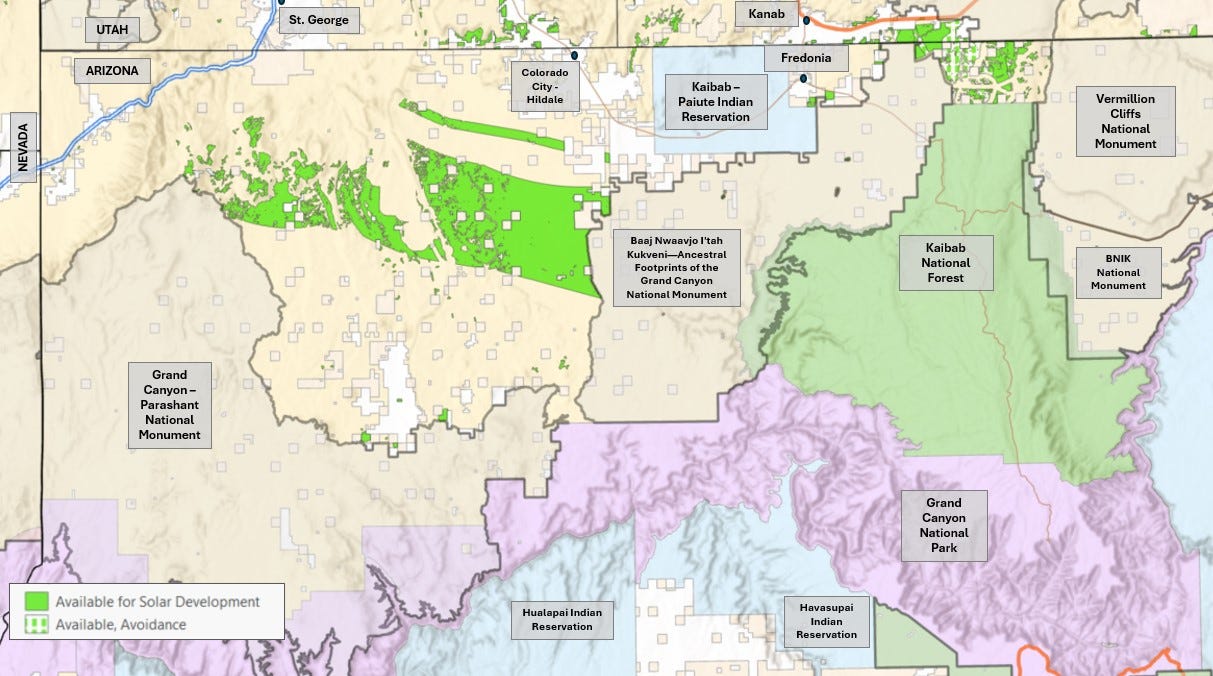
8. The Arizona Strip
The Arizona Strip is one of the wildest and least-traveled places in the country. With only a couple of towns, it is primarily composed of protected areas or areas unavailable for large-scale development like Grand Canyon National Park, Grand Canyon-Parashant National Monument, the Kaibab National Forest, Vermillion Cliffs National Monument, and one of our nation’s newest protected areas, Baaj Nwaavjo I'tah Kukveni—Ancestral Footprints of the Grand Canyon National Monument.
And yet… the Western Solar Plan makes a very large swath of the Arizona Strip available for solar energy. In addition to the large contiguous parcel north of Parashant Monument, there are also numerous parcels in the area of Fredonia, getting perilously close to Kanab and Grand Staircase.

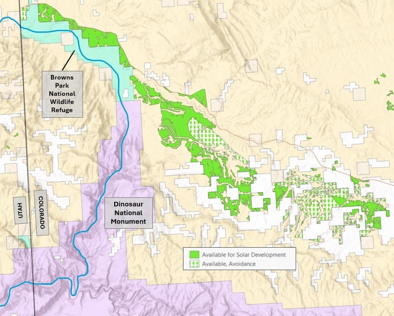
9. Dinosaur National Monument & Browns Park, Colorado
The area north of Dinosaur National Monument in Colorado is targeted for solar energy in the Western Solar Plan. This includes significant acreage spanning the boundary of the nearby Browns Park National Wildlife Refuge, along the shores of the Green River. This sort of widespread development along the boundaries of protected areas threatens to sever connectivity and render them protected islands in a sea of development. This greatly diminishes their ecological value, as well as their value for visitors.

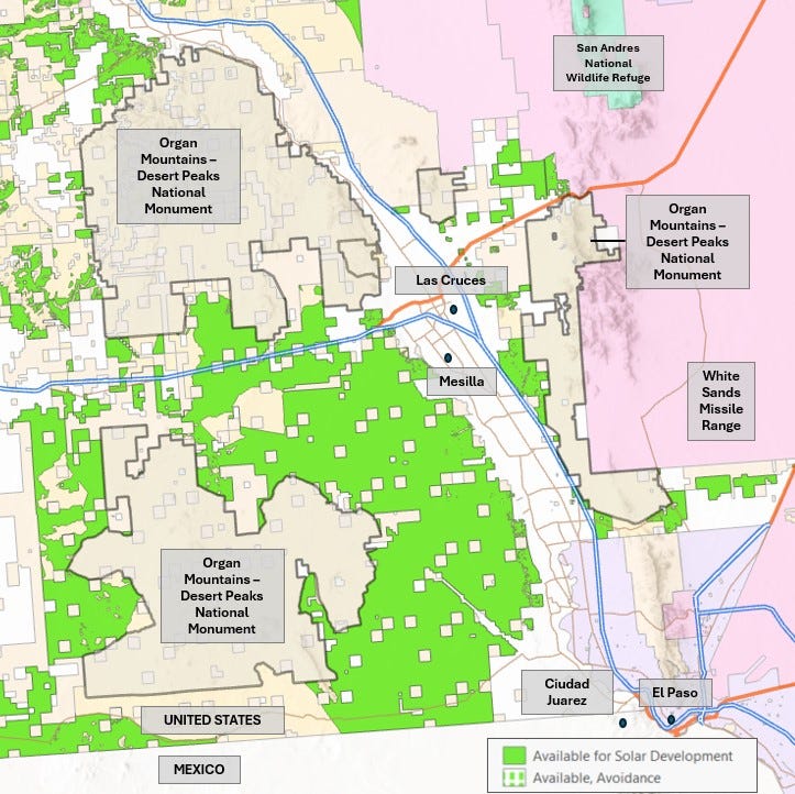
10. Organ Mountains-Desert Peaks National Monument, New Mexico
Public lands surrounding some units of the Organ Mountains-Desert Peaks National Monument in New Mexico are allocated for solar in the Western Solar Plan. I know very little about this area so I won’t make much editorial comment other than to say that, again, the value of a protected area is severely diminished when it is completely surrounded by development.

11. Esmeralda County, Nevada
This one hurts. Esmeralda County is being asked to shoulder the burden of the nation’s clean energy transition. Just over 1,000,000 acres of the 2.3 million acre county is being made available for solar energy under the Western Solar Plan – totaling 46% of the county. That’s an area larger than Rhode Island – within a single county.
Lands available for solar include habitat for imperiled species like the Tecopa bird’s beak, and groundwater dependent ecosystems like the Fish Lake Valley wetlands. The lands made available for solar come right up to people’s homes and property.
This county also happens to be one of the least populated counties in the country, with just 744 residents. It has the second lowest median household income in the country. There are no grocery stores. There are no gas stations. There are no doctors. It is a beautiful and wild place. The people who live here have little access to political power; little money to hire experts; little available resources to assert themselves in ensuring their community remains vibrant in the face of such development. This doesn’t seem like the right approach to the energy transition.

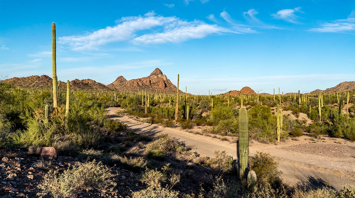
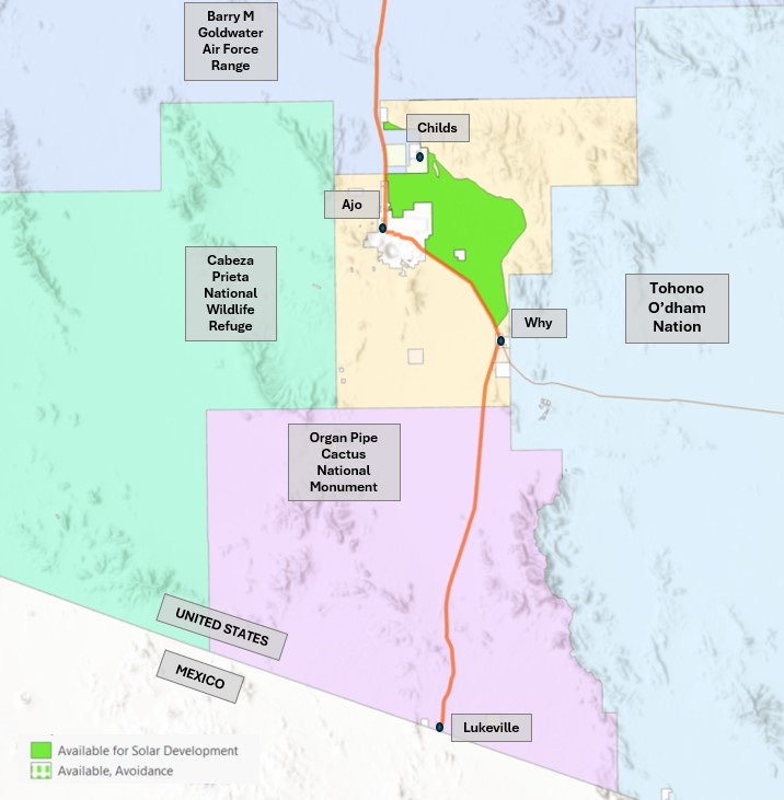
12. Ajo, Arizona
The small historic mining town of Ajo, Arizona is completely surrounded by reserved lands. To the south is Organ Pipe Cactus National Monument. To the west is Cabeza Prieta National Wildlife Refuge. To the east is the Tohono O’dham Nation. And to the north is Barry M. Goldwater Air Force Range. The town of Ajo and a couple of smaller settlements nearby are in a hole between these four areas, with a large chunk of unprotected BLM land surrounding it. And, surprise surprise, the Western Solar Plan makes most of that BLM land available. As the gateway to a National Park Service managed monument and wedged between numerous areas unavailable for development, this seems like exactly the wrong sort of place to target.
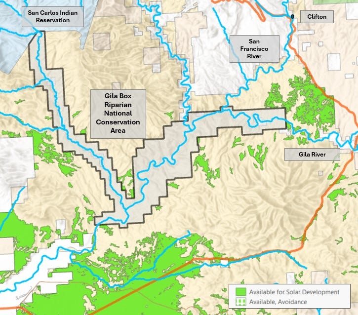
13. Gila Box, Arizona
The Gila Box Riparian National Conservation Area is a relatively obscure protected area near Safford, Arizona which includes the beautiful Gila River and its box canyon. The Western Solar Plan would make lands surrounding the Gila Box and nearby Gila River available for solar energy, thereby significantly diminishing the ecological value of the National Conservation Area.

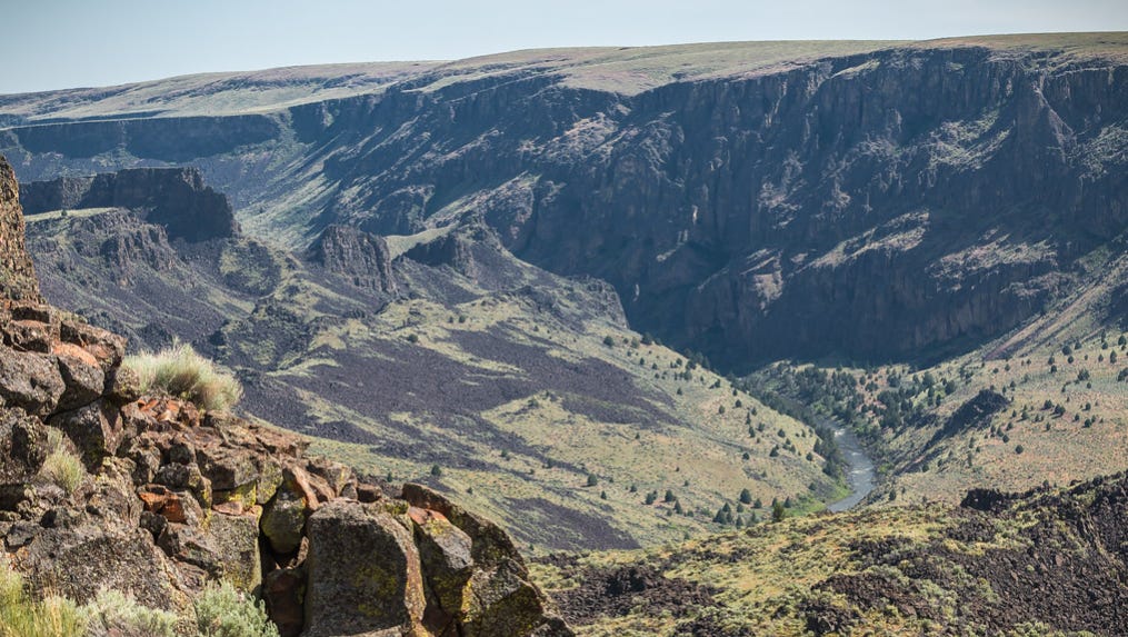
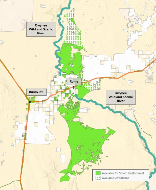
14. Owyhee River, Oregon
Areas along the Owyhee Wild and Scenic River are being made available under the Western Solar Plan. These land allocations come directly down to the shores of the protected river, obviously impacting the values for which the river was protect to begin with. This area is also being advocated for protection as the proposed Owyhee Canyonlands National Monument. While it’s as yet unclear if these solar allocations impinge on the monument’s boundaries, it’s clearly a landscape-scale disturbance which will have consequences for the protected areas and unprotected areas surrounding it.
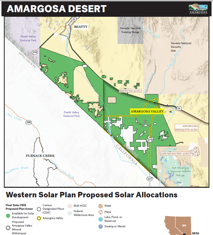
15. Amargosa River Basin, Nevada
The Amargosa River Basin is an area of extraordinary biodiversity, with the highest concentration of endemic species of any single HUD8 watershed in the nation. The Amargosa River, the lifeblood of the Basin, flows above ground at a series of spring-fed oases, which harbor plants and animals, like the Devils Hole pupfish and the Amargosa niterwort, found nowhere else on Earth. This is also the homeland of the Timbisha Shoshone and Southern Paiute peoples.

It is also the site of a major resource extraction boom, as lithium and gold mining companies have their sites set on valuable minerals beneath the ground. But their operations will require vast quantities of water – water depended on by the wildlife and communities that call the Amargosa River Basin home.
The Western Solar Plan allocates approximately 220,000 acres in the Amargosa River Basin for solar energy.
This includes approximately 160,000 acres in the Amargosa Desert area surrounding the community of Amargosa Valley, Nevada. This land comes very close to Ash Meadows National Wildlife Refuge, and completely surrounds the Big Dune Area of Critical Environmental Concern. It also comes right up to peoples’ homes and property in Amargosa Valley, threatening to permanently alter their way of life.
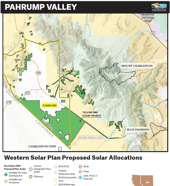
In Pahrump Valley to the east in the Amargosa River Basin, the plan allocates approximately 60,000 acres for solar energy, mostly located within important desert tortoise habitat. The existing Yellow Pine Solar project had to clear 150 tortoises from the project footprint. There are a half dozen other projects proposed on BLM land here which will likely encounter hundreds more. Pahrump Valley is also in critical groundwater overdraft, and the high amounts of water required for dust suppression threaten to exacerbate groundwater drawdown. Like in Amargosa Valley, lands available for solar come right up to people’s homes in Pahrump.
Keep up with Amargosa Conservancy to learn the latest on pushing back to save the Amargosa River Basin.

Sobering, isn’t it? The scale of the whole thing is so vast that it’s very difficult to conceptualize all at once. It affects everywhere differently of course, but everywhere stands to lose.
A pervasive theme here is “proximity to protected areas.” This is an important concept - protected areas are interconnected with larger landscapes. In order for them to have value that connectivity must be maintained. Otherwise they are simply islands of protection, isolated from the greater ecosystem, doomed to become museum pieces for tourists. There is no specific buffer associated with protected areas, but it should have been readily apparent to BLM in putting together this plan that some places should be avoided.
It could have been so different. Within those 31 million acres are many places that could be more appropriate for solar. Degraded areas. Areas converted to cheatgrass. Former mine sites. Public lands adjacent to other industrial uses. Literally millions of acres of such land have already been identified – there are ample opportunities to put solar on public lands in the West without destroying these 16 places and so many more.
In our next newsletter we’ll tackle that issue and more. The book hasn’t been written yet on the Western Solar Plan. There is still a chance for BLM to change its mind and write a different script. Stay tuned… the resistance is forming.
(All photos and maps by me unless otherwise indicated. And yes the maps are janky we have better ones coming)
Horrifying, enraging. All abstraction to easterners and urbanites, all heartache for we westerners who treasure our empty landscapes. I've been to most of the places listed and what is proposed would effectively destroy them. We are just now escaping the clutches of Big Oil, only to fall into the even worse grasp of Big Solar.
What can us laymen do???